North Pole Map Pictures, Images and Stock Photos
Browse 1,000+ north pole map stock photos and images available, or search for world map or seal habitat to find more great stock photos and pictures.
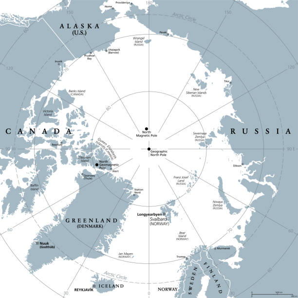
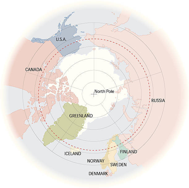
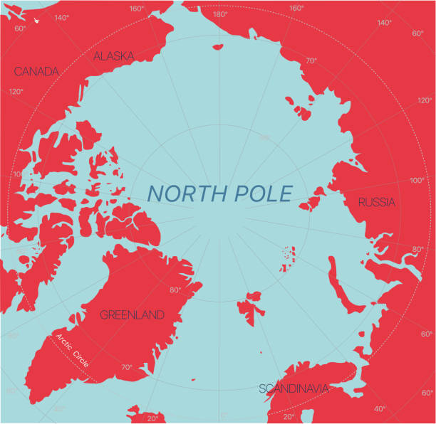
Arctic region, gray political map. Polar region around North Pole of Earth. The Arctic Ocean region, with North Magnetic Pole and North Geomagnetic Pole, longitudes and latitudes. Illustration. Vector
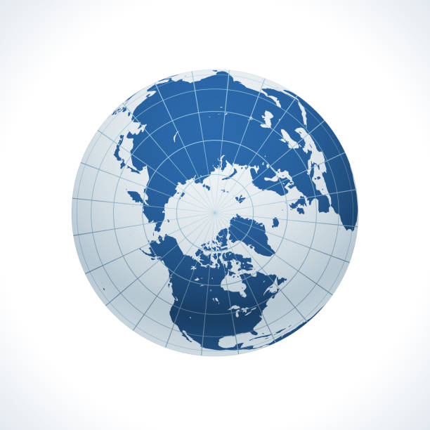
Earth realistic sphere with meridians and parallels. 3D vector illustration. Carefully layered and grouped for easy editing. You can edit or remove separately the grid, the sea the lands, the light and shadows.
Vector illustration of precise map of Arctic region.
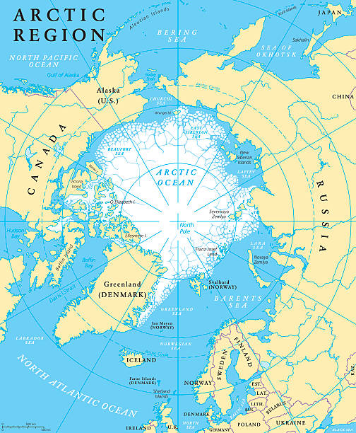
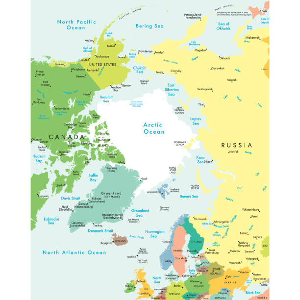
Arctic region map with countries, capitals, national borders, rivers and lakes. Arctic Ocean with average minimum extent of sea ice. English labeling and scaling. Illustration.
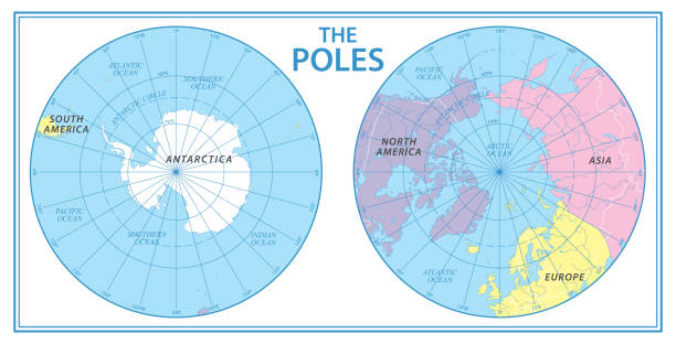
The Poles - North Pole and South Pole - Vector Illustration
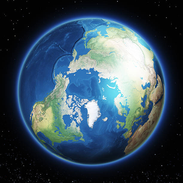
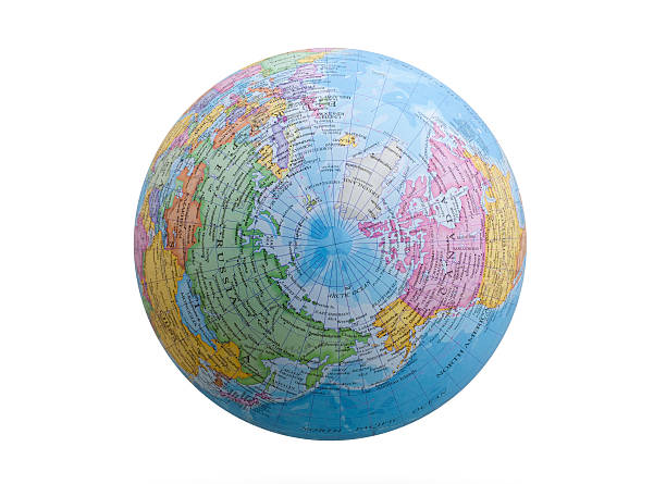
Planet Earth with North Pole in front. The colors in the .eps-file are ready for print (CMYK). Included files are EPS (v10) and Hi-Res JPG (4922 x 4922 px). Made with Natural Earth. The source data is in the public domain. URL of source data: http://www.naturalearthdata.com
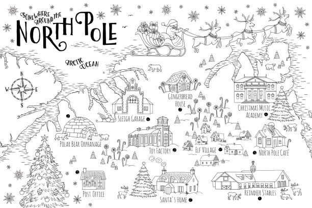
Fantasy map of the North Pole, showing the home and toy factory of Santa Claus, reindeer stables, elf village etc. - vintage Christmas greeting card template
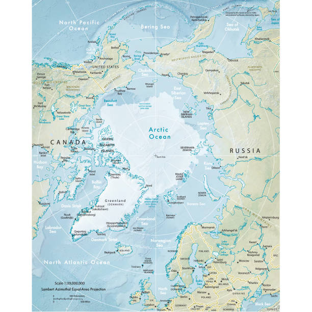
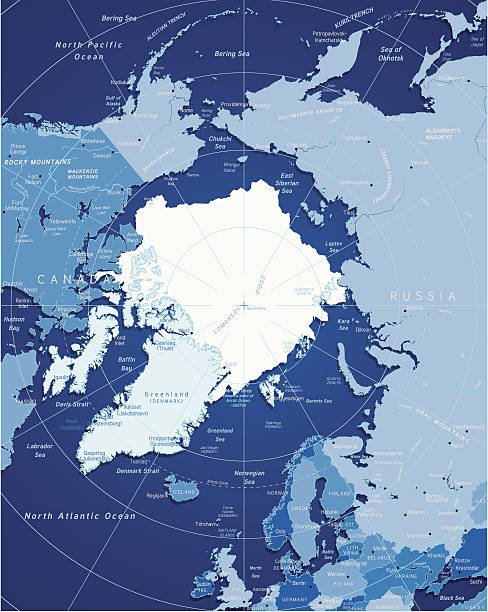
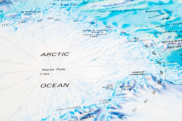
Vector illustration of the physical map of the Arctic region. Reference map was created by the US Central Intelligence Agency and is available as a public domain map at the University of Texas Libraries website. https://www.cia.gov/library/publications/resources/the-world-factbook/graphics/ref_maps/physical/pdf/arctic_region.pdf
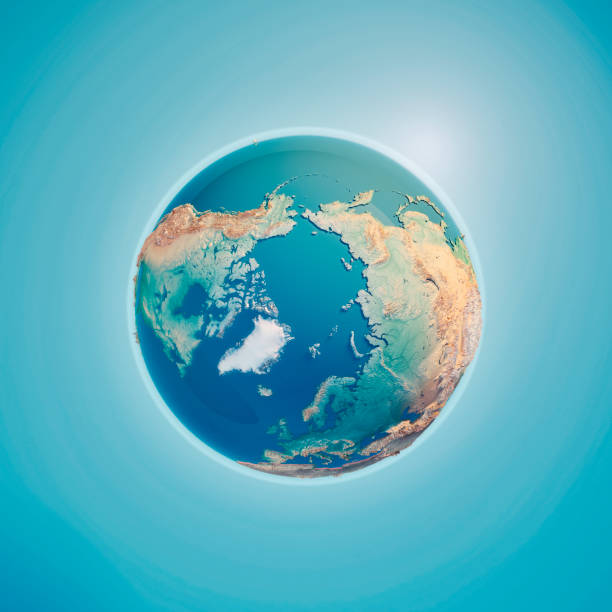
North Pole 3D Render of the Planet Earth. Made with Natural Earth. URL of source data: http://www.naturalearthdata.com
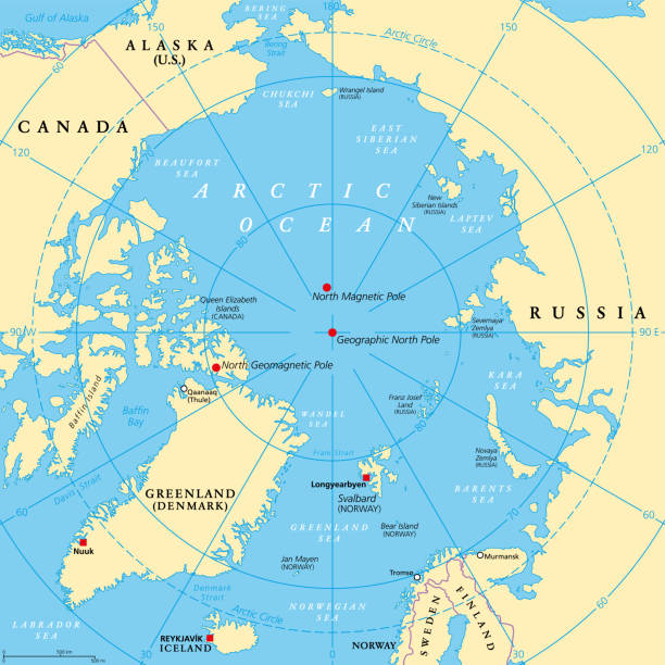
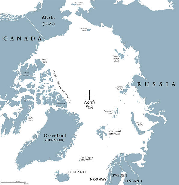
Geographic position of the North Pole of the Earth, political map. Magnetic, Geomagnetic and Geographic North Pole. Map of the Arctic Ocean and the Arctic Circle with latitudes and longitudes. Vector.
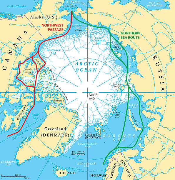
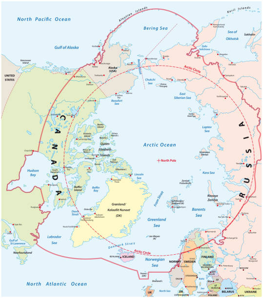
Arctic Ocean sea routes map with Northwest Passage and Northern Sea Route. Arctic Region map with countries, national borders, rivers, lakes and average minimum extent of sea ice. English labeling and scaling.
Planet Earth with North Pole in front. The colors in the .eps-file are ready for print (CMYK). Includedfiles are EPS (v10) and Hi-Res JPG (4922 x 4922 px). Made with Natural Earth. The source data is in the public domain. URL of source data: http://www.naturalearthdata.com

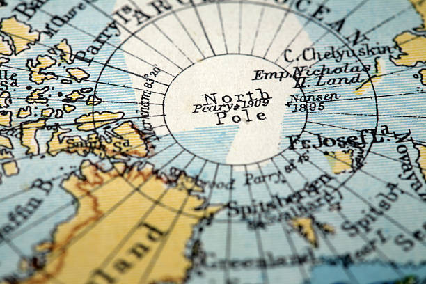
vintage map of polar regions.original engraving by W & A K Johnston from the Brittanica encyclopedia ninth edition dating from between 1875 to 18889
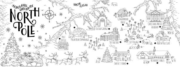
Fantasy map of the North Pole, showing the home and toy factory of Santa Claus, reindeer stables, elf village etc. - vintage Christmas greeting card template

Earth globe with meridians and parallels. 3D vector illustration. Carefully layered and grouped for easy editing. You can edit or remove separately the grid, the sea and the lands.
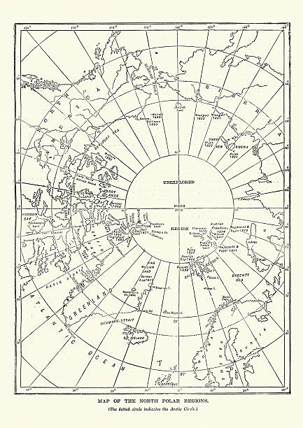
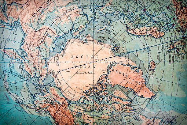
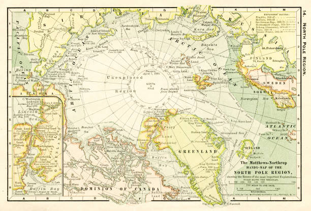
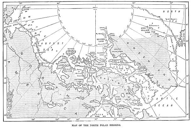
Map of the North Polar Region from 1891
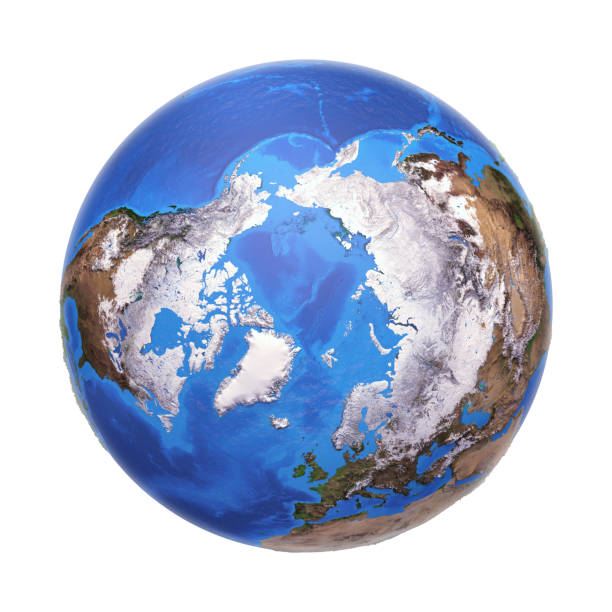
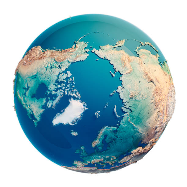
Arctic region viewed from a satellite. Physical map of North Pole in winter, February. 3D illustration of planet Earth isolated on white, with high bump effect - Elements of this image furnished by NASA.
Map of the arctic region. Vector file — will scale to any size without loss of quality.
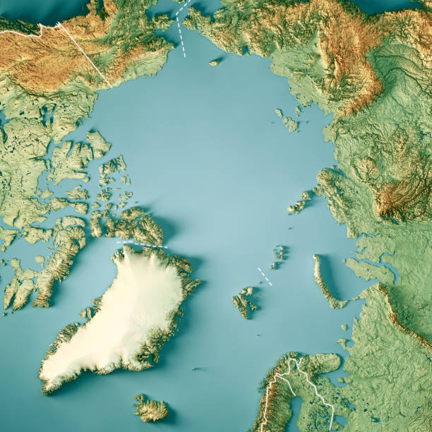
3D Render of a Topographic Map of the Arctic Ocean, North Pole. Version with Country Boundaries. All source data is in the public domain. Color texture: Made with Natural Earth. http://www.naturalearthdata.com/downloads/10m-raster-data/10m-cross-blend-hypso/ Relief texture: GMTED2010 data courtesy of USGS. URL of source image: https://topotools.cr.usgs.gov/gmted_viewer/viewer.htm Water texture lakes: Made with Natural Earth. https://www.naturalearthdata.com/downloads/10m-physical-vectors/ Water texture: HIU World Water Body Limits: http://geonode.state.gov/layers/?limit=100&offset=0&title__icontains=World%20Water%20Body%20Limits%20Detailed%202017Mar30
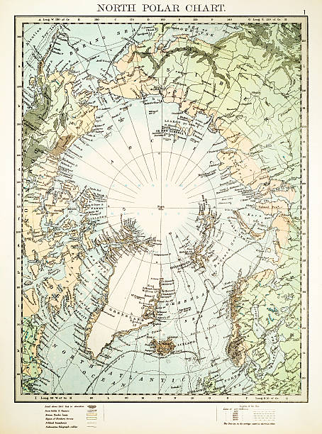
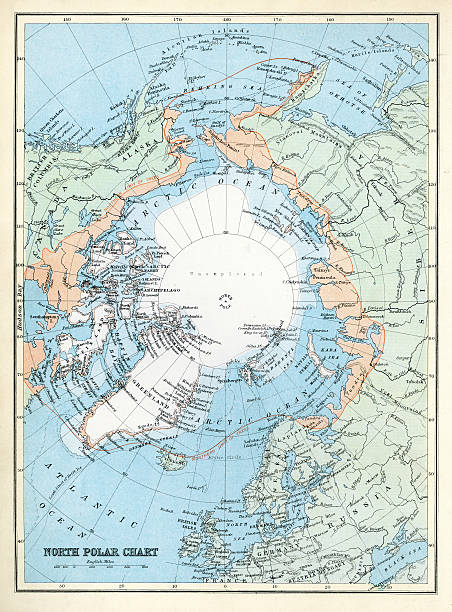
North Polar Chart
Ancient map of the Arctic Region. Lithograph, published in 1883.
Vintage engraving showing a Victorian map of the North Polar Regions
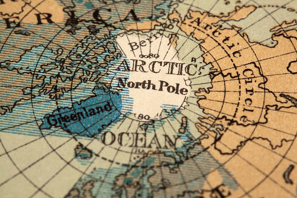
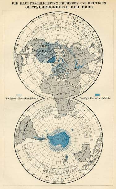
antique map of the north pole region. original map dated 1887. shaded blue areas represent former glacier region
Vintage north circumpolar map. Printed in London, 1858.
Vector illustration of the political map of the arctic region.
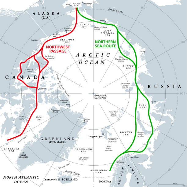
Arctic Ocean sea routes, gray political map. Arctic shipping routes. Northwest Passage and Northern Sea Route. Maritime paths, used by vessels to navigate through the Arctic. Illustration. Vector.
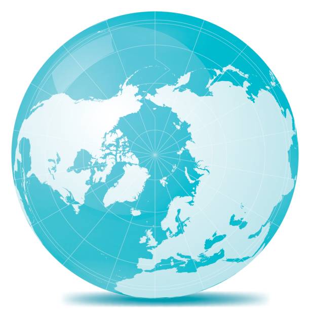
Arctic pole globe hemisphere. World map view from space on white
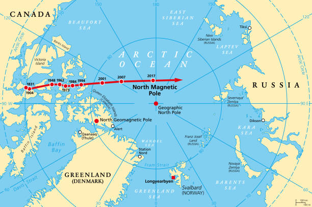
Movement of North Magnetic Pole, political map. Magnetic North pole of Earth moves over time, according to magnetic changes in outer core, across Canadian Arctic, Arctic Ocean towards Siberia. Vector.
North Pole 3D Render of the Planet Earth.
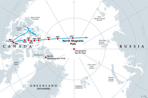
Movement of North Magnetic Pole, gray political map. Magnetic North pole of Earth, observed since 1831. The pole is drifting across the Canadian Arctic, over the Arctic Ocean, towards Siberia. Vector.
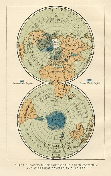
antique world map from 1887 showing former and present glacier regions.original engraving by F.Temsky, Prague 1887.
Der Menfch Vol 2 by Johannes Ranke - Leipzig 1894
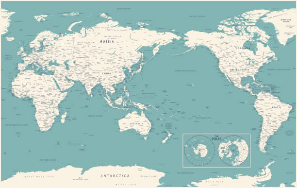
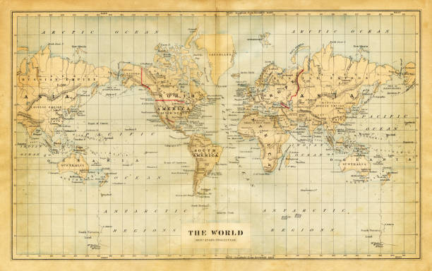
World Map - Pacific China Asia View - Vintage Political Topographic - Vector Detailed
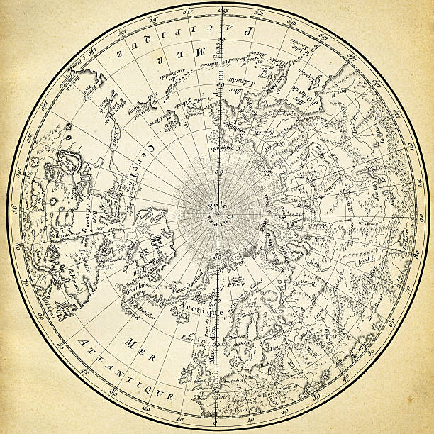
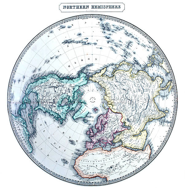
Ancient map of the northern hemisphere. Illustration was published in 1746 atlas.
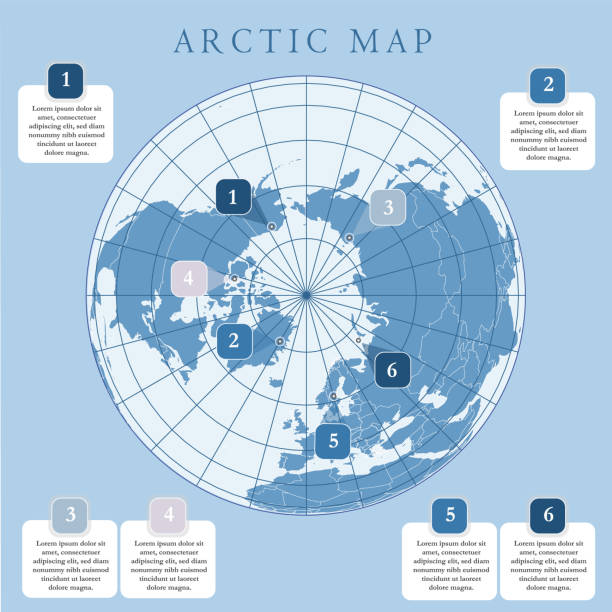
North Pole detailed editable map with regions geographic sites. Vector EPS-10 file
Earth and space full of stars
Maury's Geographical Series - The Word we live in by M.F. Maury LLD - New York and Baltimore 1876
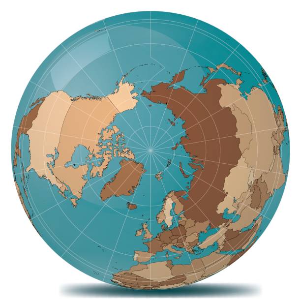
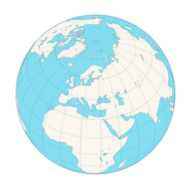
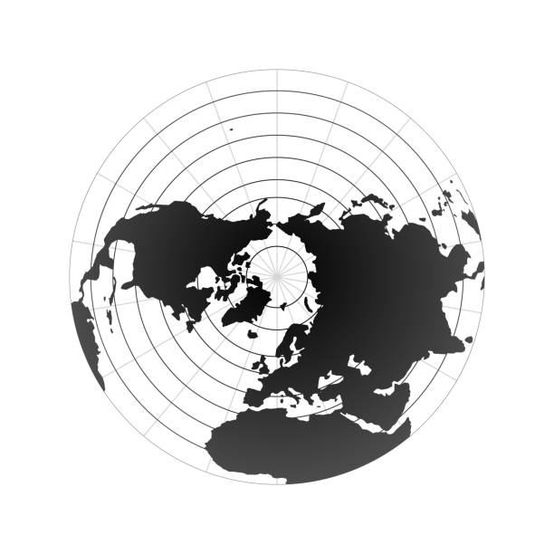
Globe. Northern hemisphere. To see more Globes images click on the link below:

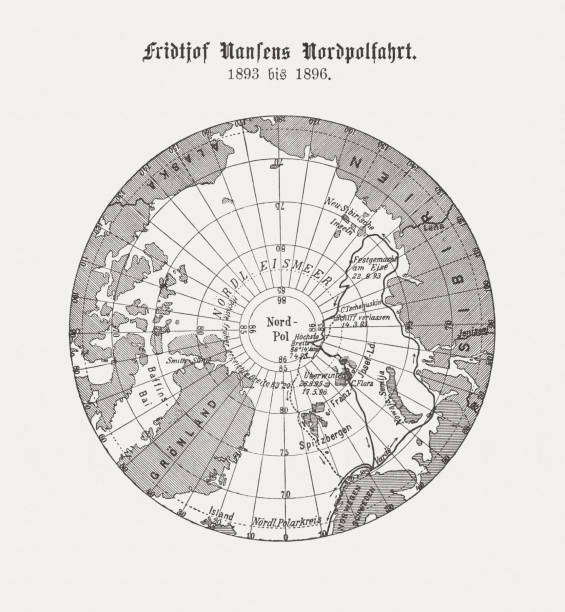
Fridtjof Nansen's northern polar expedition (1893 - 1896). Together with Fredrik Hjalmar Johansen, on April 8, 1895, with a latitude of 86 ° 13.6 'N, he set a new record with the closest approach to the geographic North Pole. Wood engraving, published in 1898.
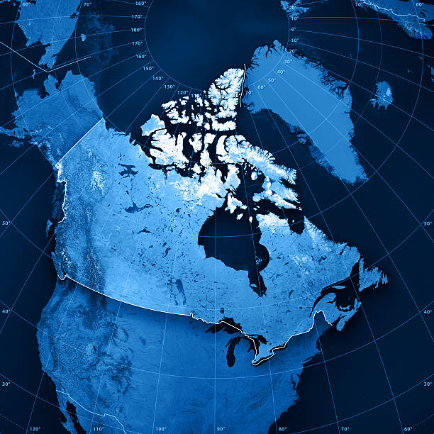
"3D render and image composing: Topographic Map of Canada. Including country borders, rivers and accurate longitude/latitude lines. High resolution available! High quality relief structure!Relief texture and satellite images courtesy of NASA. Further data source courtesy of CIA World Data Bank II database.Note: This image is perfectly congruent to the image"
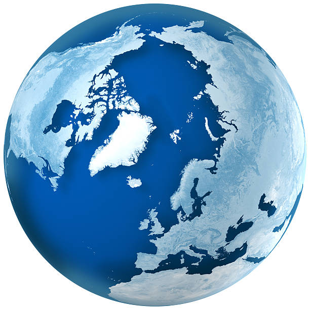
"3D rendering of blue earth with detailed land illustration. the North Pole, Europe, Asia, and North America view.Made with Natural Earth. Free vector and raster map data @ www.naturalearthdata.com"
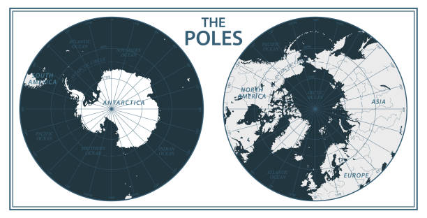
The Poles - North Pole and South Pole - Vector Illustration. Black and White
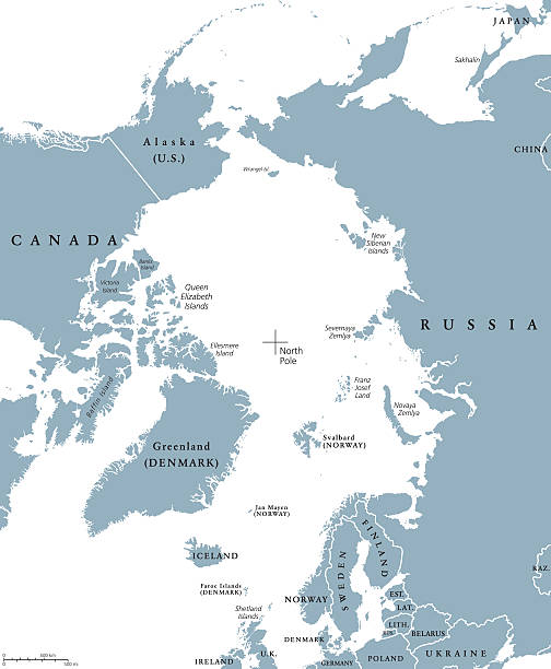
Arctic region countries and North Pole political map with national borders and country names. Arctic ocean without sea ice. English labeling and scaling. Illustration.
Map from the Complete Handy Atlas of the World - 1898
world globe icon. vector earth logo. web global symbol with grid
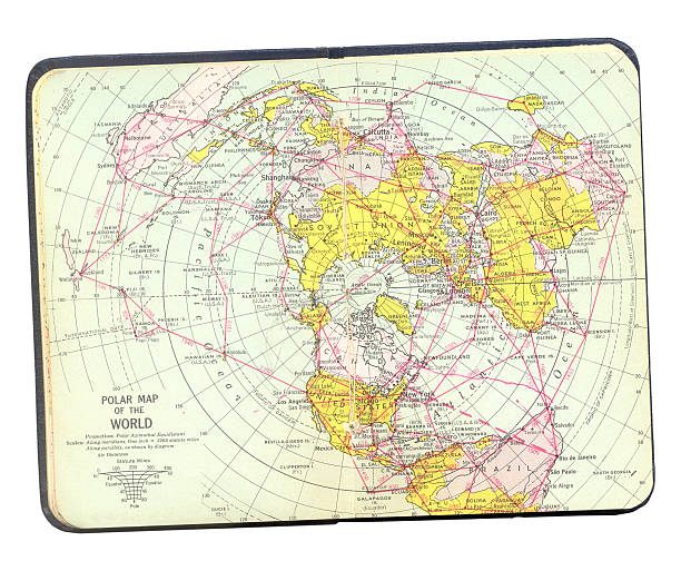
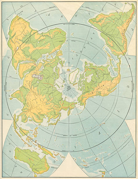
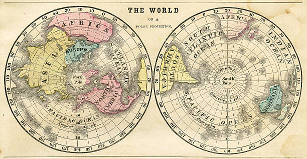
Polar map of the world.
vintage map of the North pole and surrounding regions.
Vintage engraving from 1878 showing a Map of the North Polar Regions
Arctic region political map. Polar region around the North Pole at the northernmost part of Earth. The Arctic Ocean without ice. Gray illustration with English labeling on white background. Vector.
North Pole map.
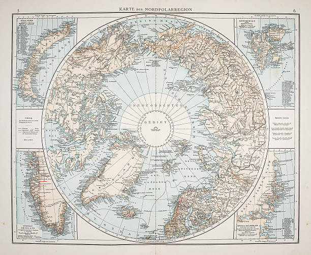
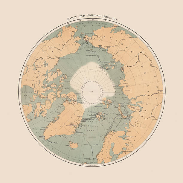
Meyers Konversations-Lexikon.
Colton and Fitch's Modern School Geography by George W. Fitch - New York 1856.
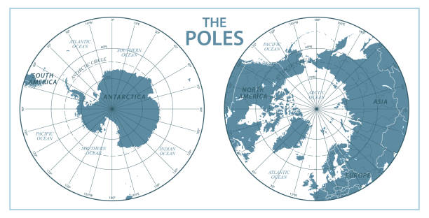
The Poles - North Pole and South Pole - Vector Illustration. Gray and White