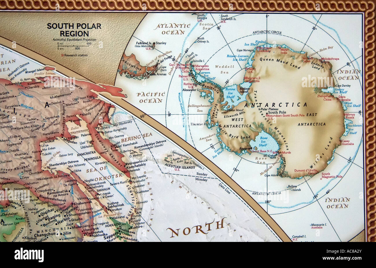
A view of the South Pole region of the earth on a fine, detailed and colorful World map.
RMID:Image ID:AC8A2Y
Image details
Contributor:
Steve Ohlsen / Alamy Stock PhotoImage ID:
AC8A2YFile size:
49.2 MB (3 MB Compressed download)Releases:
Model - no | Property - noDo I need a release?Dimensions:
5174 x 3325 px | 43.8 x 28.2 cm | 17.2 x 11.1 inches | 300dpiDate taken:
3 March 2007Location:
5669 West 4480 South West Valley City, Utah, USA (my Home Office)More information:
A current (2005) world map. Here shows a portion of the map that displays the earth's South Polar region. This wall map is of a high quality and has fine color detail and labeled locales for any geographical needs. Any other world or United States individual states map images available upon request.